Welcome to Dartmoor Ilsington Walk
Route Details
Terrain: Green lanes with some steep hills, and rough underfoot. Route can be wet in places after rain so appropriate footwear is advisable.
Time: approx. 2 hours
Distance: approx. 5km (3 miles)
Facilities: Toilets and Visitor Centre at Haytor
Parking: Ilsington Parish Hall (when not in use)
Summary: The earliest documented reference to Ilsington is as a manor in the Domesday Book of AD 1086 when it was held by the colourfully named Ralph Pagan. This walk takes you through the village and along its surrounding green lanes with stunning views of the village and Haytor Rocks.
Download route1. Repairing Ilsington
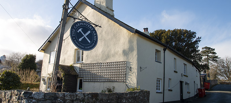
Turn left out of the car park and follow the road past the pub. Take the left hand turn at Simms Hill and follow the lane down the hill. The lane becomes rocky and can be muddy at times. Continue along the lane and up a steep hill until you reach a crossroads of lanes. In 1938, many of the cottages in Ilsington were condemned under Ministry of Health Guidelines and described as ‘miserable hovels’. Captain Quelch, a retired local architect and builder, purchased the cottages and drew up a schedule for the restoration work. Thus preserving the character and history of the village.
2. Exploring the Green Lanes
At the crossroads take the left hand lane. As you walk look out for the amazing views to Haytor and back onto Ilsington village to the West and North. Continue along the lane, downhill and follow the track as it bears right to the road.
3. Moor Views
At the road turn right, walk along the road for 100 metres until you come to a lane on your left. Take this turning and follow the lane up the hill. At the top you will come to a junction, turn left here and continue, again taking in the views of Haytor. The rocky granite outcrops or tors dominate Dartmoor’s landscape and have been formed by the weathering of granite which was formed over 280 million years ago. Continue walking along the lane until you reach the road. At the junction with the road, to the right, is an early 19th century granite signpost, marked with directions to Bovey Tracey, Manaton, Ilsington and Newton on the appropriate faces.
4. River Valleys
Follow the road in front of you up the hill, continuing until you reach a kissing gate on your left. Go through the kissing gate and follow the hedge round to your left to the next small wooden gate. Continue on the track through the woods. Making your way downhill and to the river, walk upriver to the road.
5. Back to Ilsington
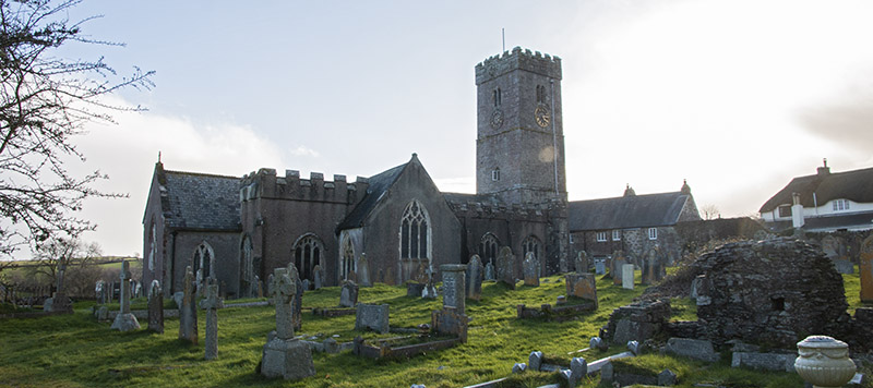
At the road, turn left to the T junction. Here, turn right up the hill back to the village. At the church turn left. Within the church grounds lie the ruins of the 16th century manor house. John Ford acquired the manor in the early 16th century and it is thought to have fallen into disrepair in the 19th century. Make your way past the pub stopping for refreshments either here or in the village shop.