Open access and rights of way
One of the things that makes Dartmoor so special is the open access to the commons where you can walk freely rather than sticking to footpaths. But there are also hundreds of miles of paths and tracks which you can use. These include around 730 km (449 miles) of public rights of way (footpaths, bridleways and byways) as well as other paths and tracks where the owner allows access.
It is important to understand where you can go and what you can do when using the National Park. Help us to Love Moor Life by following the Ranger Code.
Public Rights of Way
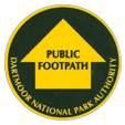
Public Footpaths
Open to walkers and mobility aid users only.
Waymarked in yellow and shown as short green dashed lines on OS Explorer Maps
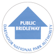
Public Bridleways
Open to walkers, mobility aid users, horse-riders and cyclists.
Waymarked in blue and shown as long green dashed lines on OS Explorer Maps
Visit Ride Dartmoor for comprehensive information on horse riding on Dartmoor
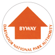
Byways Open To All Traffic
Open to all users including motorised vehicles.
Byways are the only rights of way of way where it is legal to take a motor vehicle so you should always check that a route is a legal byway.
On Ordnance Survey Explorer Maps, byways are marked by green crosses. They will be signposted as a byway at the start of the route.
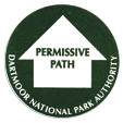
Permissive Paths
Permissive paths are paths that are not public rights of way, but which the landowner has agreed can be used by the public.
On Ordnance Survey Explorer maps, permitted routes are sometimes shown by orange lines (short dashes for footpaths and long dashes for bridleways). Not all permitted routes are shown on the maps. You should also look out for signposts at the start of routes and way markers along the route.
Access Land
On the moor you are free to choose your own walking route and you don’t have to keep to public rights of way. Access Land is shown on the OS maps as yellow wash.
Dartmoor Commons – for walkers and horse riders
Countryside and Rights of Way Access Land (CRoW) – for walkers
Where can I find out more?
Ordnance Survey maps show rights of way and many permissive paths. The Outdoor Leisure Map (OL 28) covers most of Dartmoor National Park and is available from National Park Visitor Centres.
For ideas on where to cycle, see our Cycling page or try the 'Dartmoor for On and Off Road Cyclists Map' available from our Visitor Centres.
Find walking routes for all on our Walking pages.
Access and Rights of Way notices
Temporary closures and other Access and Rights of Way notices can be found on the Access and Rights of Way notices page.
Report a Path Problem
Report a problem on a public right of way
A38 Corridor Walking and Cycling
Visit the A38 Corridor webpage to have your say on how walking and cycling can be improved between Ivybridge and Bovey Tracey